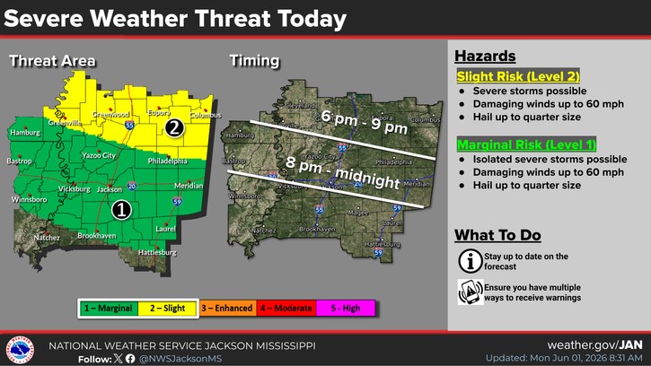
Parts of this area are now under a Level-2 “slight” risk of severe storms today and tonight with a Level-1 “marginal” risk continuing for the rest of the area. In Attala, Holmes, Carroll, Montgomery, Choctaw, Winston, northern Leake and northern Neshoba counties, damaging winds and hail will be possible with storms expected to be more isolated elsewhere in the local area. A severe thunderstorm watch has been posted for much of north Mississippi.
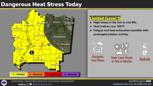
In the west, heat index readings up to 105 degrees are possible as temperatures in the 90s combine with high humidity to make conditions uncomfortable and potentially dangerous. The worst of the heat stress is forecast from southeastern Mississippi up through the western part of the state including western Holmes County.