
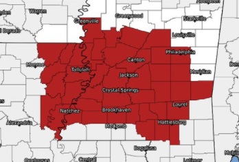
CARTHAGE, Miss.–Hurricane Ida strengthened into a category 4 storm Sunday, with top winds at 150 mph, making it a “top-end category 4 storms”, with more strengthening possible. For central Mississippi, that could mean widespread wind damage.
Even though the winds will likely not be that strong when it reaches this part of the state, there could be some damage.
LISTEN: Daniel Lamb discusses main central Miss. threats from IDA
“As the system moves northward, we’re gonna see some pretty strong winds,” said Daniel Lamb, with the National Weather Service. He estimated winds in central Mississippi could gust up to 65 mph.
“When you consider there’s also gonna be quite a bit of rain, you’ve got rain-soaked soils, winds of that magnitude, particularly lasting over an extended period of time, it’s gonna knock down quite a few trees,” said Lamb.
He said the potential for flooding also exists, with rainfall of up to 8 inches or higher. He said the potential for tornadoes also exists, possibly through Monday night and Tuesday.
900 AM CDT #Ida update: Northern eyewall of #Ida approaching the coast of southeastern Louisiana https://t.co/tW4KeFW0gB pic.twitter.com/dy4hQufcNZ
— National Hurricane Center (@NHC_Atlantic) August 29, 2021
With those multiple threats, you should be prepared for power outages that could last quite a while.
You can download the Breezy101, Kicks96 and Cruisin98 apps to keep up to date with the storm and storm threats as she passes over central Mississippi.


