
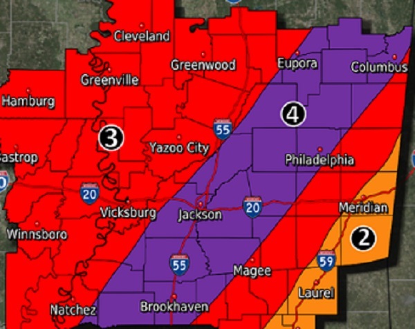
The winter storm has been upgraded to extreme for our area. We just spoke with EMA Director Tommy Malone who said the upgrade of the storm to extreme could create a major event of historic proportions. “We could see potential ice accumulation of 1/2″ plus. We are also in the extreme risk for dangerous low temperatures dropping into single digits with wind chill temperatures below zero. Timing is through this evening/night, possibly light rain/sleet mix with light accumulation with the worst moving in around daylight in the morning until early afternoon. But what falls is likely to freeze and not thaw up until possibly Wednesday, but we have the potential for another system to move in late Wednesday into Thursday. Right now it’s too early to speculate on what will develop from it. This is going to be a serious, and possibly even dangerous event. Folks need to prepare for potential impassible roads and bridges and the potential for extended power outages.” Once again everyone is advised to stay off the roads and practice all safety precautions. We will continue to update as soon as possible.


