PHILADELPHIA, Miss.–A cold front will come through the area in the next couple of days and bring a change in high temperatures. By Thursday the high will be 66. But, the front is moving slowly and whn it finally does come through, Friday’s high will be in the mid 50s.
As the front pushes toward our area, there’s a possibility strong storms could form.
“We could still have some strong storms as some moisture and warmth is able to penetrate into our area,” explained Logan Poole, a meteorologist with the National Weather Service.
He said a warm front is stalled along the coast and because it is not moving further north, the chances for strong storms aren’t high.
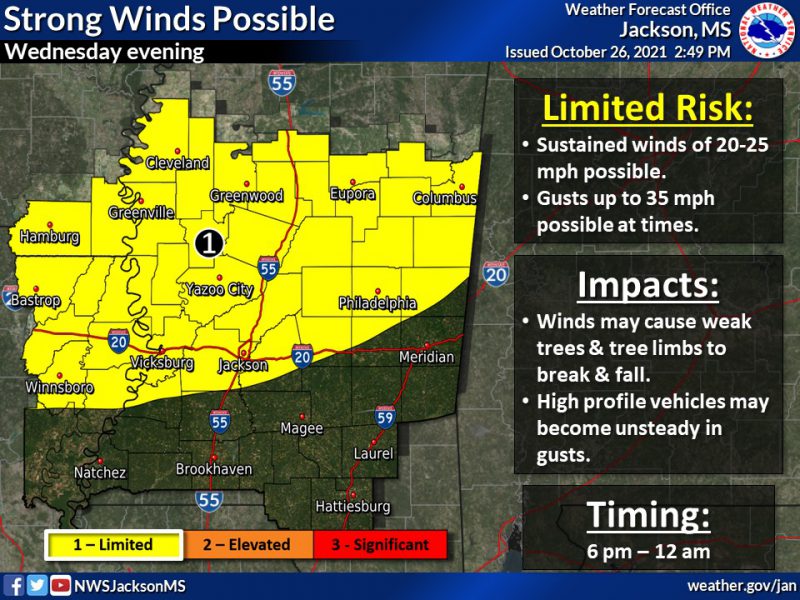
After another cool night tonight, possible severe thunderstorms will be a concern for locations especially around and south of the Hwy 84 corridor in LA & MS. Some gusty winds can be expected behind the cold front Wed. night as well. #lawx #mswx #arwx pic.twitter.com/6gy3e1cVFj
— NWS Jackson MS (@NWSJacksonMS) October 27, 2021
“It’s not looking like it’s a terribly high-end severe weather threat today, but there is a chance and that’s what we’ll be monitoring particularly as we head into the afternoon and evening,” he said.
But, the most apparent effect will be the winds.
“So, it will be windy, even after the cold front comes through tonight, winds out of the west and northwest, still pretty gusty.”