
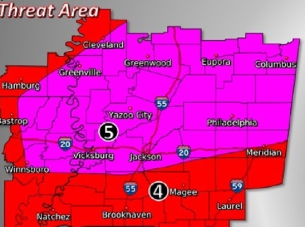
The National Weather Service has announced that “significant severe storms are likely across the area today. As things warm up, portions of east and southeast Mississippi may get a round of severe thunderstorms from late morning into the afternoon. By late afternoon, a cold front and line of storms will approach the area from the west, where the environment will be warm, moist and unstable. As storms sweep across the region, damaging wind gusts, large hail and tornadoes will be likely. Some violent and long track tornadoes will be possible.”
*** Strong and violent tornadoes with extreme winds and destructive hail greater than tennis ball size are possible in our Central Mississippi region.
Timing in Central Mississippi is 1pm-12am.


