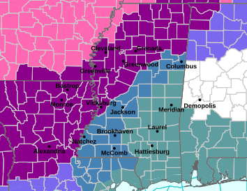
(Ice Storm Warning shown in violet on map above, Winter Storm Warning in pink, Winter Storm Watch in blue-gray and Extreme Cold Watch, only a portion of which is shown in gray.)
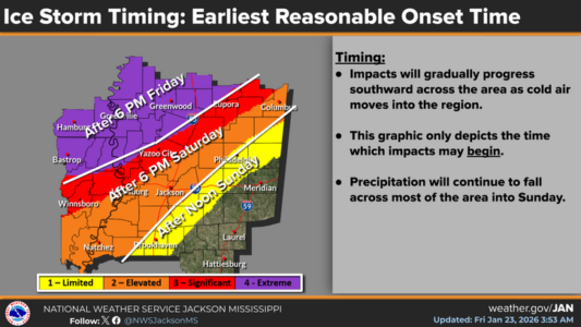
The Ice Storm Warning has been expanded to include Holmes, Carroll, Montgomery, Grenada, Webster and Yazoo counties, in effect from 6 pm this evening until 6 pm Sunday. The National Weather Service says between one-tenth to a quarter-inch of ice accumulation is possible in these areas on Saturday.
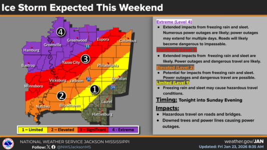
Attala, Leake, Choctaw and Winston counties are still included in a Winter Storm Watch which will be in effect from Saturday afternoon through Sunday afternoon. Freezing rain could begin in these areas after midnight tonight. (Note: the NWS graphic below has been adjusted again resulting in more of Attala County being put back into the Level-3 “significant” band.)
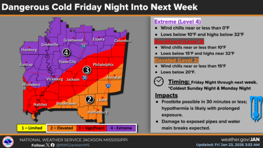
Brutally cold weather is expected beginning Sunday night with lows around 15 in Philadelphia, between 10 and 15 in Carthage and around 10 degrees in Kosciusko and Durant. By Monday morning, wind chills could drop to around zero. Lows Monday night are forecast to fall to between 5 and 10 degrees in Philadelphia, to near 5 degrees in Carthage, between zero and 5 degrees in Kosciusko and to near zero in Durant. An Extreme Cold Watch has been posted for much of the state from Sunday evening through Tuesday morning.