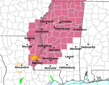
(Severe Thunderstorm Watch shown in pink on map above)
A severe thunderstorm watch will be in effect until 7 pm for the entire local area including Attala, Holmes, Leake, Neshoba, Carroll, Montgomery, Choctaw and Winston counties.
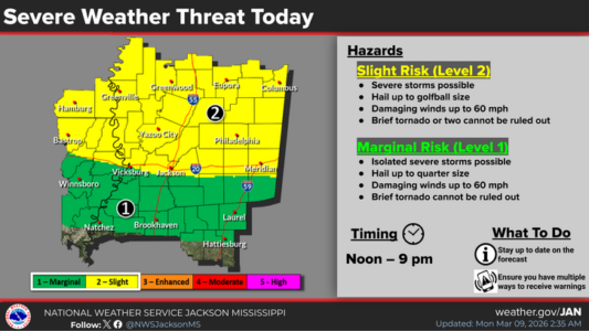
After a brief break from the storms Sunday, more potentially rough weather is poised to moved into Mississippi today. And these storms could be packing large hail, up to golf ball size. Most of Mississippi north of I-20 is under a Level-2 “slight” risk of that hail and damaging wind gusts this afternoon and tonight. The National Weather Service says a brief tornado or two can’t be ruled out.
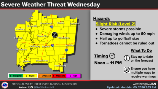
Then on Wednesday, a cold front is forecast to trigger another round of severe weather with most of the state under a Level-2 risk. Again, damaging winds and large hail will be possible and tornadoes can’t be ruled out.