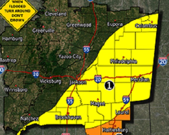
As a tropical disturbance lifts across Mississippi Friday night through Saturday, flash flooding will be possible for areas along and southeast of Natchez to Jackson to the Columbus line, according to the National Weather Service in Jackson. The highest potential for flooding will be across the Pine Belt, where 3-6″ of rain is expected, and locally higher amounts are possible. A localized flood threat is anticipated across the limited threat area. Leake Emergency Management Director Tommy Malone said as of now there is a slight chance for rain late Friday, with a 70% chance on Saturday and Saturday night. Some wind gusts are possible up to 20-30 miles per hour. 2 to 3 inches of rain is possible for our area. Malone also said that all of this can change as the storm develops and a definite track can be established. NWS Jackson reminds us that flash flooding is possible in our area. We will keep you updated as this weather event progresses.
Related Articles
Loading advertisement…