
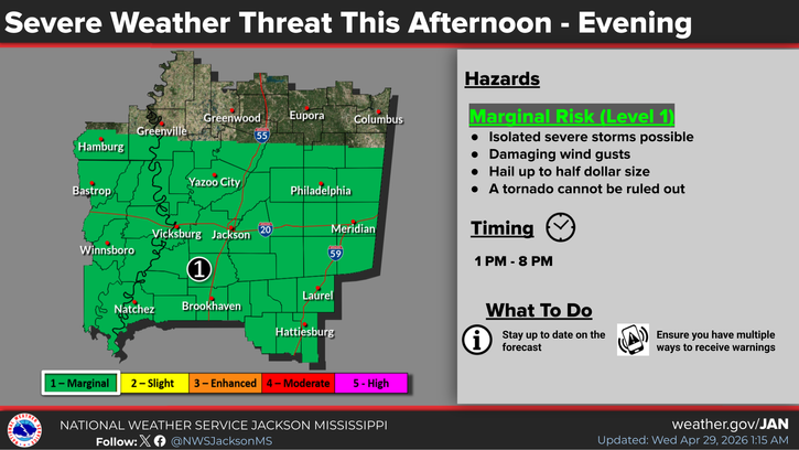
As a cold front pushes into central Mississippi today, more strong to severe thunderstorms will be possible. Most of the local area has been placed under a Level-1 “marginal” risk of damaging winds and hail up to half-dollar size. The National Weather Service says a tornado can’t be ruled out.
This comes on the heels of Tuesday’s storms which arrived in two waves, the first one packing some large hail up to golf ball size across the local area along with some wind damage. In northern Attala County, a tree was blown down in a road east of Shady Grove. And near the Winston-Neshoba County line, roof damage was reported to a home south of Plattsburg.


