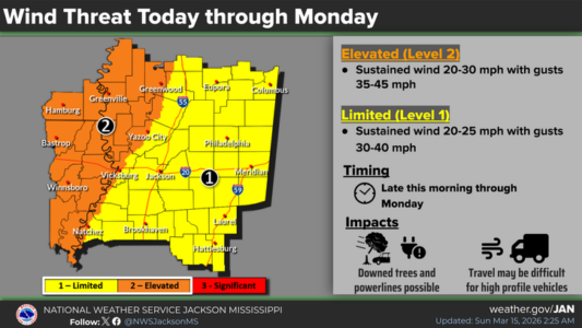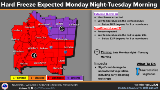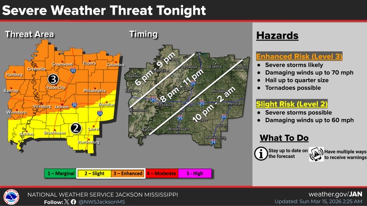
This part of central Mississippi will be under a Level-3 “enhanced” risk of severe storms tonight with damaging winds up to 70 miles an hour, hail and tornadoes possible. The storms are expected to move through quickly after 8 pm. Ahead of the storms today, gusty southerly winds are forecast with sustained winds up to 25 miles an hour and gusts to 40. After the storms, the winds will turn around and become northerly through Monday. A wind advisory will be in effect. Some snow showers will be possible in parts of central Mississippi Monday morning. Monday night, temperatures will plummet with most of the local area facing a Level-4 “extreme” hard freeze with lows in the low to mid 20s.