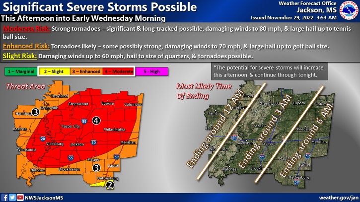
The National Weather Service has now expanded a Level-4 “moderate” risk of tornadoes, damaging winds and large hail for to cover all of the local area this afternoon and tonight. The next-to-the-highest threat level means that NWS expects strong tornadoes (EF-2 to EF-3), including some that could be “significant” and “long-tracked”. Straight-line winds up to 80 miles an hour and tennis ball sized hail are also possible. The storms could continue until early Wednesday morning. Flash flooding is another concern.
Related Articles
Loading advertisement…