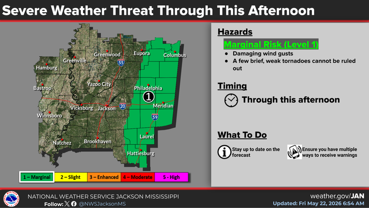
Eastern parts of the local area are now under a Level-1 “marginal” risk of damaging wind gusts and a few brief weak tornadoes through this afternoon. The risk area has been expanded slightly to include eastern Leake County and eastern Choctaw County as well as Neshoba and Winston counties. The National Weather Service says it’s a low-end tornado risk but says a few weak twisters can’t be ruled out because of favorable wind shear in the lower levels of the atmosphere across eastern Mississippi.
NWS says a brief tornado touched down around 4:30 this morning in Hinds County south of Raymond. A storm spotter reported some tree damage.
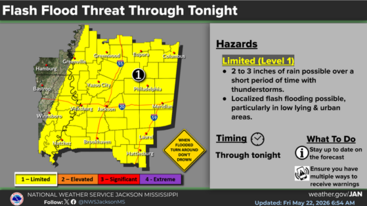
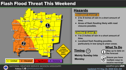
Heavy rain is still the more widespread weather concern. NWS is highlighting a continuing risk of flash flooding across the entire area through this weekend.