
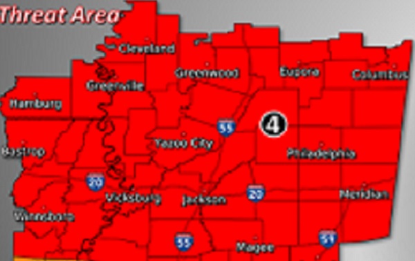
Severe weather is likely today. According to the National Weather Service “a significant weather event will take place today. After some morning thunderstorms, additional thunderstorms will develop and move into the region during the afternoon. These storms will be capable of producing damaging wind gusts, large hail, and tornadoes. Some tornadoes could become strong and long tracked. Multiple rounds of storms are expected between 1pm today until 12am Thursday.” Leake Emergency Management Director Tommy Malone said “I would advise folks to make plans ahead of time to locate a safe place they can go. It’s looking like we could start seeing potential discrete cells develop after lunch. I don’t like to see these forecasts. These are the cells that can spring long track deadly tornadoes. We are also probably looking at the front to come through as a squall line around 8:00 pm. Even though squall lines typically don’t promote the super cell tornadoes, they can still produce tornadoes and damaging straight line winds.”
We will keep you updated with the latest weather information as it becomes available.


